Internet Mapping Tools & Sites
A few of my favorite internet tools that deal with land, mapping and real estate. Warning, many of these can suck you in for hours if you aren’t careful. 🙂
Free Map Tools Area Calculator
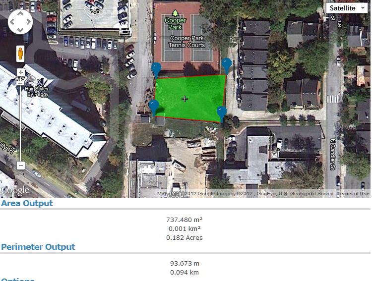
Need to see how large a particular area is in acres? Great for mapping out potential farming plots, amount of area available for solar panels, estimating fencing (perimeter), preliminary plotting to subdivide a lot and so on. Powered by Google Maps, just search, scroll or zoom to the area you want, and start plopping down markers. The markers will automatically be connected. Add more marketers for unusual shapes, drag markers around or delete markers as needed. The Area Calculator then automatically calculates square meters, square kilometer, acres and perimeter measurements. The Free Map Tools site has several other fun and useful map tools, but this is the one seems to have a lot of practical applications.
Zillow

Not particularly new, but good to see it is still going strong even after the fate that hit many online start up and real estate tools and businesses. Zillow is a monstrous mash-up of geo-location, real estate listings and economic trending to provide an speculative eye on house values (using a proprietary algorithm called the “Zestimate”) with the ease of Bing maps (that is not a typo). The accuracy of value can vary (instability, current events, and individual property improvements/degradation).
Sea Level Rise Explorer
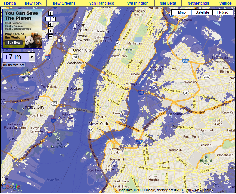
On a grimmer note, this map allows you to view various locations around the world and use a selector to choose your level of sea level rise (from a modest 1 meter rise to a catestrophic 60 meter rise) and see what areas would be lost beneath the waves.
Housing Maps
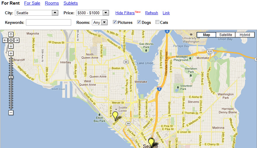
A mash-up powered by Google Maps and Craigslist, Housing Maps pulls data together to let you view housing listings (rentals, sales, rooms, sublets) and filter by price, keywords, pets, number of rooms and pictures. If you are looking for a place by area, this is much easier than just using Craigslist and constantly checking Google Maps. Drawbacks, not everyone that lists a property provides accurate or complete location data (intentionally or otherwise).
Wikimapia
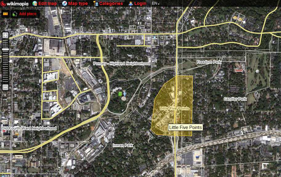
Inspired by (but unaffiliated with) Wikipedia, Wikimapia aspires to “describe the whole world”. While the are a long way form their goal, there are a ton of area that are outlined and referenced. The interface is familiar, being powered by Google Maps, and it can be fun to scroll around matching up entries to their real life location. User can draw out polygons to add new areas, append photos and contribute linear structures (like railroads, ferry lines, river and trails).